To take a “fresh and experimental look” at my surroundings I began by considering what appear to me to be the characteristic aspects of my home town of Glossop.
I did this by brainstorming aspects of the ideas about the town that have importance to me. I had not used the technique of “mindmapping” before in other work, but found it helped to generate ideas and provide a visual reference of how they interlink.
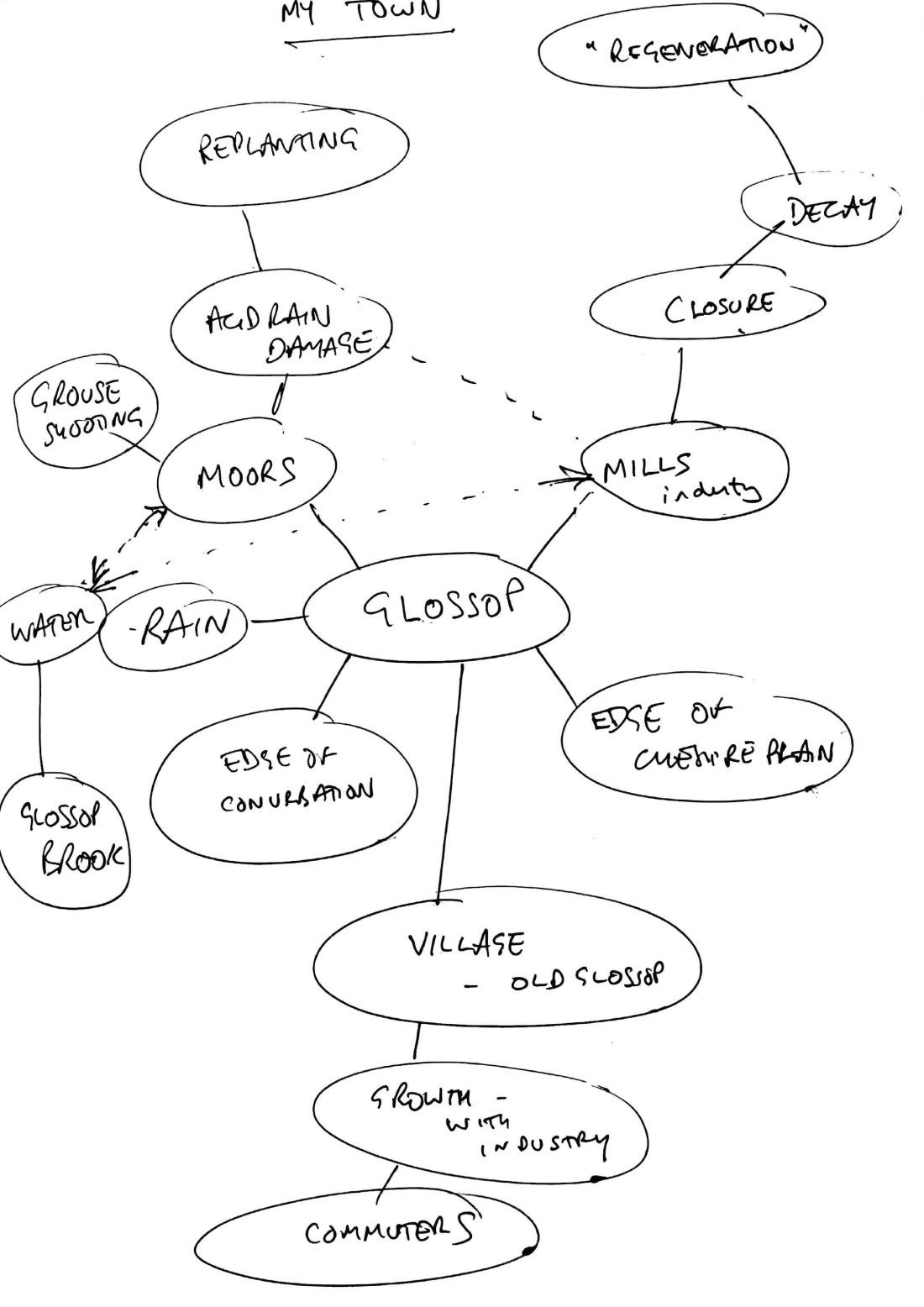
Overall I came to the conclusion that the character of Glossop comes about because it sits as transitional in many ways
- Geologically it is on the boundary between the Pennines and the Cheshire Plain
- It sits between rural landscapes and urban landscape, on the edge of the Greater Manchester Conurbation
- Functionally it grew as a rural village, to an industrial town and is now undergoing post-industrial change and the industry base closes
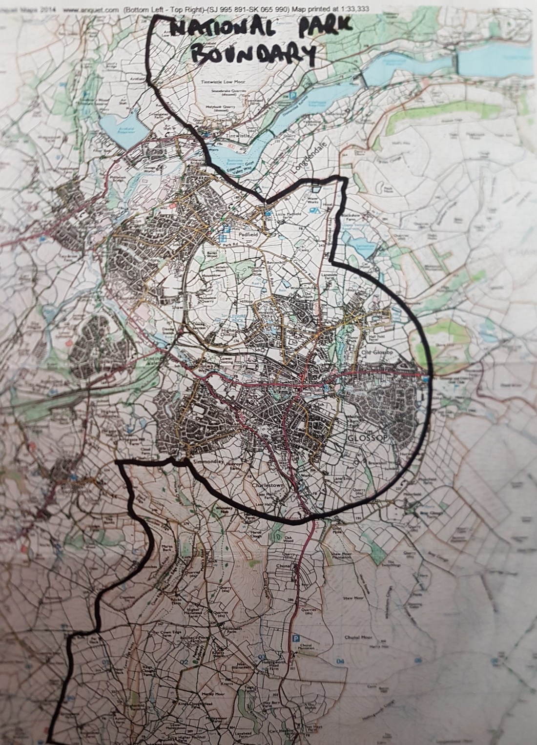
An aspect of this is illustrated visually by the map showing it is encircled by the National Park, forming and industrial/post-industrial island in the Park.
One theme came over as important and seemed to link many aspects. These are the rivers flowing through the town. Rising in the peat on the moors, the rivers then flow down the valleys into the town and through it onto the plain eventually joining the Mersey.
Water has influenced
- the development of the peat and the scenery of the moors
- been used for agriculture
- for power for industry for both water power and steam
- created the climate suitable for cotton spinning
My initial plan is for my series of images to follow the rivers and use them to illustrate changes in Man’s relationship with them over time.
