Convergence of the rivers – Waterside Branch Line

The 1911 map shows the Waterside Branch running along the side of the Etherow having crossed a viaduct. Today this looks far from industrial and has been developed as a bridle-way.

Waterside
OS Six Inch Series – 1911 ‘Reproduced with the permission of the National Library of Scotland’

I wanted images of the river flowing into the lowland rural farmland, and also to illustrate how the regenerative process has hidden this aspect of its industrial past.

My first visit was just to explore the area and look for locations. 2018-08-18 Glossop EYV-1

2018-08-18 Glossop EYV-7

These images show the area without a hint of the railway which ran on the right hand bank of the far river or the viaduct crossing the near one. The only hint is the iron work remaining in the river.

Nearby today however is the council tip and this is as intrusive into a rural scene as the old railway, and shows how the access to the river is still controlled.

2018-08-18 Glossop EYV-16

2018-08-18 Glossop EYV-4

I was looking for a view of the river leaving the post-industrial area to the rural and wanted something like this.

2018-08-18 Glossop EYV-14

Although this does not show any suggestion of change of use, so more like this is preferable to me.

2018-08-18 Glossop EYV-12

I have revisited with tripod and polarising filter to retake these to add what I think is a better quality of depiction of the water.

2018-08-20 Glossop EYV-3

Other images from the revisit also show that.


2018-08-20 Glossop EYV-82018-08-20 Glossop EYV-242018-08-20 Glossop EYV-122018-08-20 Glossop EYV-29


I will aim to use some of these in my final submission.


Square Mile – Story Board

I worked this out before my earlier posts, but have only just got round to scanning the pages of my sketches!

Having decided to look at the rivers in Glossop and use the images of these as my vehicle for the assignment, I started to plan the locations I needed to communicate my objectives.
I approached this as a storyboard, describing the path the rivers take from the hills, through the town and out onto the plain and to the conurbation of Manchester in the distance. The sketches are from memory and serve me as an aide-memoire for the aspects of the landscape I want to illustrate.
The moorland above Glossop would provide images of the sources of the water, but also the effects on the peat of the industrialisation. Completing a cycle, it would also enable showing Man’s influence and attempts to restore this with new planting and attempts to stop peat erosion. Lower down in Doctor’s gate a bridge is a memorial to a rambler and illustrates the use of the land for recreation.

Square Mile Story Board_Page_1
Moorland sketches of my proposed storyboard

Associated with that is also the agricultural influences such as altered river course for sheep washes.

Further down the valley are more obvious agricultural influences on the landscape, and as the river approaches Old Glossop, a pre-industrial village, it flows close to workers cottages. However this scene also incorporates modern factories in use today.

Square Mile Story Board_Page_2
Rural and village scenes – Old Glossop and its old agriculture and new factories

Through the town the rivers are highly controlled and have been extensively used for industry, diverted into mill ponds and other structures. This old industrial heritage can still be seen, but as it decays nature regenerates to create new vegetation.

Square Mile Story Board_Page_3

Finally, after only 6km, Glossop Brook leaves Glossop and joins the Etherow to flow onto the Cheshire plain and into agricultural land, before entering the industrial conurbation of Manchester. Here at the confluence of the rivers was an industrial branch line, the Waterside Branch, running across a viaduct and along the side of the river to the Waterside Mills. Few traces of this remain, such is the regenerative power of nature.

Square Mile Story Board_Page_4

I have now a few sites I plan to visit and develop these themes.


Howard Town Mills, Glossop


I went to look around Glossop to look for some sites to photograph and develop some ideas of how my images might look for this assignment.

As I was unsure about access, I did not take a tripod and other kit but planned to re-visit if this seemed suitable for some of the images I was looking for.

I chose a stretch of Glossop Brook, in the centre of the town where it runs through the site of the old Howard Town Mills. This was a large area of cotton mills, now disused and being re-developed as retail area, hotels, and bars. The extent of these can be seen in the OS Map of 1924:

Howard Town 1924 6inch
OS 6 inch map 1924; Reproduced with the permission of the National Library of Scotland

I found that I could get into the site of the derelict mills at the East end of the site and found these images of drosscapes.  These were not what I was looking for, but I think are interesting images in their own right.

More in keeping with my project are these:

2018-07-12 Milltown-322
Glossop Brook – near Milltown
2018-07-12 Milltown-341
Glossop Brook: Shirebrook Drive Bridge
2018-07-12 Milltown-327
Glossop Brook near Howard Town Mills, East End
2018-07-12 Milltown-325
Glossop Brook near Howard Town Mills, East End

I am pleased with these images. I think they show an apparently rural scene, however on looking carefully the remnants of the industrial past can be seen – mill walls and pipelines in the river bed. I think they show the power of nature to reclaim our derelict industrial sites.

My plan is to revisit this site with a tripod and polarising filter as I think a higher image quality can be achieved.  I would like to use a long exposure to alter the quality of the depiction of the water, and the polarising filter will show detail on the pipeline better.


Square Mile: Communicating about me

The brief says that the assignment must “communicate something about you: your interests, motivations and ambitions for your photography”.

To help me determine what I wanted to communicate about myself, I reflected on this and again used the “mind-mapping” technique (diagram not shown) to identify what I saw as key aspects of my personality that I wanted to communicate.

In summary, my interests include hillwalking and scuba diving (the latter is hard to incorporate directly into this). These are linked by an interest in nature and the natural environment. My other large area of interest is my family and friends. Through my professional work I have an interest in people generally and their interests and background.

I think the theme linking this is an interest in heritage, why and how we come to be where we are, and in terms of our environment, what has created what we see – the forces of nature and of people.

In terms of photography, I started originally to use it to document what I have done and where I have been, however I recognise that I aspire to more and want it to mean something to me (and hopefully others). One of my personality traits I am aware of is perfectionism and I enjoy the technical aspects of photography, but am never satisfied with the outcome so want to better understand the essential aspects of an image to make it good.


My aim with the assignment is to try and show

  • why and how we come to be where we are
  • what has created what we see
  • and show the forces of nature and of people on our environment


Next Steps:

In this and my last blog post I believe I have set out how I intend to approach the assignment and what I want it to show. I now need to plan the images that will do this. To this end I will:

  • Plan locations and possible images based on my knowledge of the area
  • Research the work of other photographers and artists whose work addresses this


My Initial Approach to the Brief


To take a “fresh and experimental look” at my surroundings I began by considering what appear to me to be the characteristic aspects of my home town of Glossop.
I did this by brainstorming aspects of the ideas about the town that have importance to me. I had not used the technique of “mindmapping” before in other work, but found it helped to generate ideas and provide a visual reference of how they interlink.


2018-07-06 Glossop_1
Page from my notebook – Mindmap of what Glossop means to me

Overall I came to the conclusion that the character of Glossop comes about because it sits as transitional in many ways

  • Geologically it is on the boundary between the Pennines and the Cheshire Plain
  • It sits between rural landscapes and urban landscape, on the edge of the Greater Manchester Conurbation
  • Functionally it grew as a rural village, to an industrial town and is now undergoing post-industrial change and the industry base closes

An aspect of this is illustrated visually by the map showing it is encircled by the National Park, forming and industrial/post-industrial island in the Park.


018-07-06-glossop-2.jpg
Ordnance Survey 1:25000 map of Glossop showing National Park Boundary


One theme came over as important and seemed to link many aspects. These are the rivers flowing through the town. Rising in the peat on the moors, the rivers then flow down the valleys into the town and through it onto the plain eventually joining the Mersey.

Water has influenced

  • the development of the peat and the scenery of the moors
  • been used for agriculture
  • for power for industry for both water power and steam
  • created the climate suitable for cotton spinning


My initial plan is for my series of images to follow the rivers and use them to illustrate changes in Man’s relationship with them over time.


Square Mile: The Brief and My Initial Reaction

I  began this assignment by carefully reading the brief.

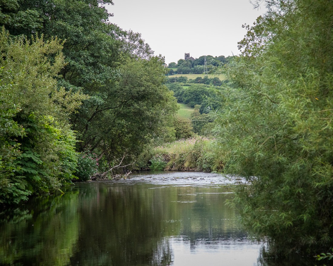
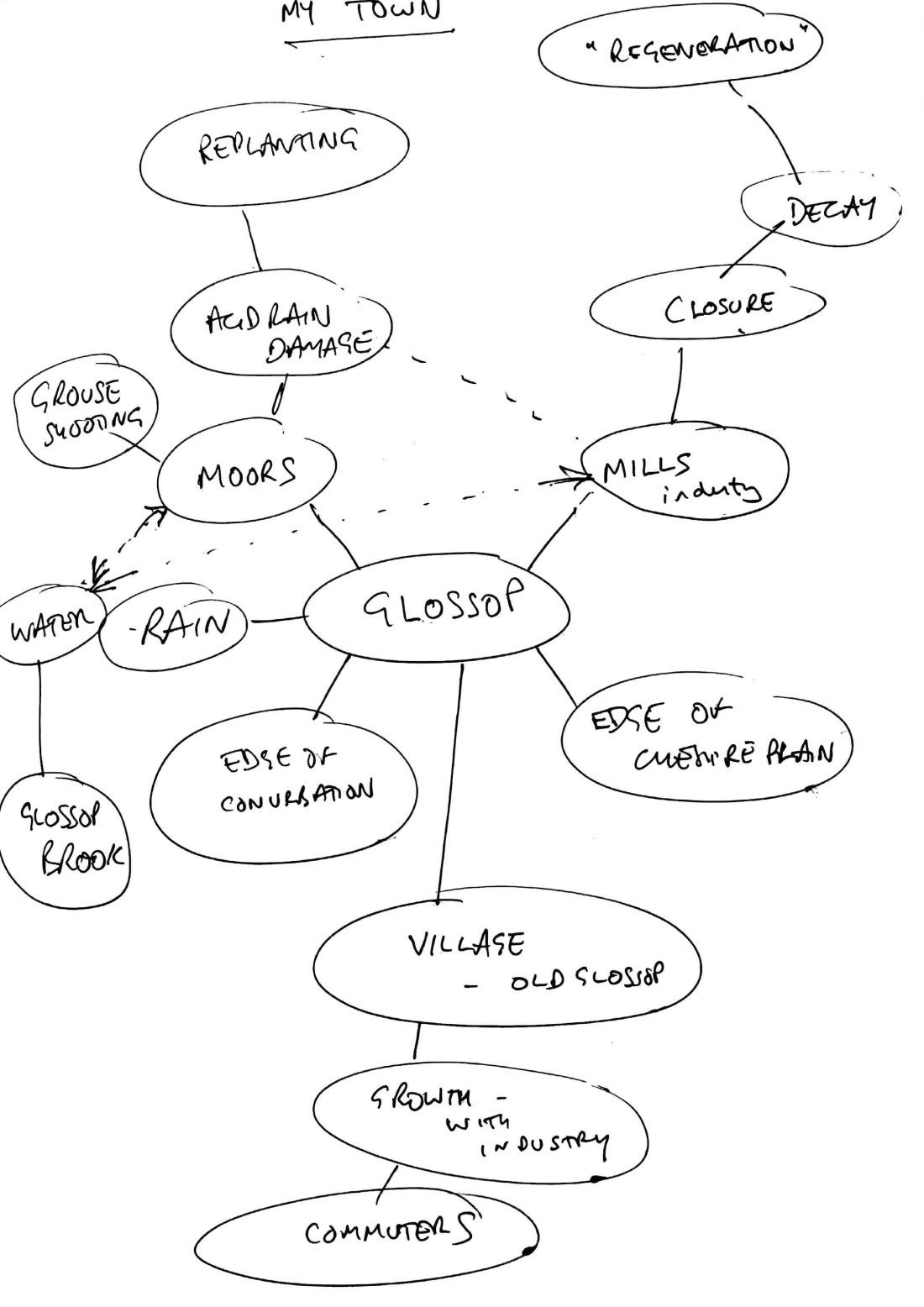
My interpretation of the brief is to produce a series of photographs in response to the concept of the “Square Mile”.

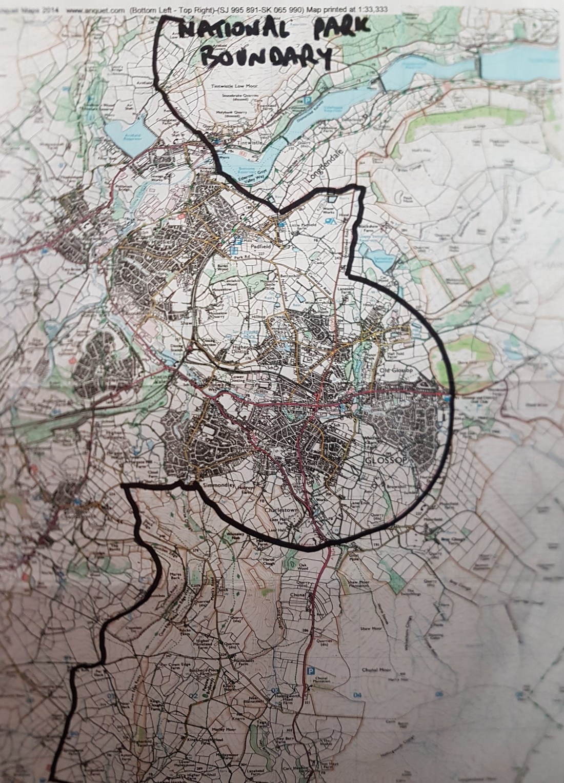
That concept is an area

  • I know in detail
  • May involve people and places
  • Knowing is sensory experience “textures, smells”


Technical Aspects

  • 6 – 12 images
  • Form a series – linked in some way not individual images
  • May have titles or captions
  • P13 of notes “keep to basic image corrections without significantly changing the image as seen through the viewfinder”

Stylistic Aspects

  • Fresh and experimental look at my surroundings
  • Involve architecture, landscape and people
  • Communicate about me, my:
    • interests
    • motivations
    • ambitions
  • Novel (to me) subject matter


The Required Submission

Although this is the last stage of the assignment, I looked at this in some detail too, as I wanted to ensure that the work I produce will easily transform into a format ready for submission and that I will have completed along the way all the elements required.

Submission needs to include:

  • Electronic images 1500 pixels on long edge, Adobe RGB jpegs
  • Digital contact sheet of all the photographs shot for the assignment
  • Written analysis to contextualise the project including
    • First impressions and response to the brief
    • Practitioners looked at for inspiration and influence
    • Technical approach
    • Self-assessment of strengths and weaknesses
    • Thoughts on improvement


The self-assessment and reflection needs to be against the assessment criteria in the course guide. These are:

  • Demonstration of Technical and Visual Skills
  • Quality of the outcome, including presentation of work, conceptualisation of thoughts and communication of ideas
  • Demonstration of creativity
  • Context ie reflection, research and critical thinking


My Initial Response and thoughts about the brief

In terms of the practical skills needed to produce the actual submission, I am happy that I have the IT skills to produce the electronic outputs and submit the images in the required format.

I have not used digital contact sheets and will need to learn how to do that from my usual software (Lightroom).

The images must have only basic corrections, which is how I tend to work currently.

I am used to writing documents and providing a written submission should be well within my previous experience.

Reflection and self-assessment are skills I have to use in my professional work outside this course, and while I need to set up processes for capturing my reflections, this is not a new skill to me. Self-assessment in this context however will be more difficult as I an unsure about the standards needed.

This latter point also makes me unsure about my technical and visual skills and I will be looking for feedback as to how to improve these.

The major area where I feel I need to work hardest will be in the development of creativity and novel approaches to the subject. Linked to this is a lack of knowledge about the work of others so a major objective for me will be to research the work of others and analyse how this influences my own work.

Next Steps

  • Check how to create contact sheet
  • Set up blog/notebook/record keeping systems
  • Research other practitioners’ work
  • Consider how to approach this and what aspects to address